Has anyone seen, or have a Copy of... Star Trek Maps
Yes, I have a set. While they date from 1980, well before TNG and the "Alpha/Beta" quadrant arrangement, they have nicely detailed interstellar coordinate and navigation systems.
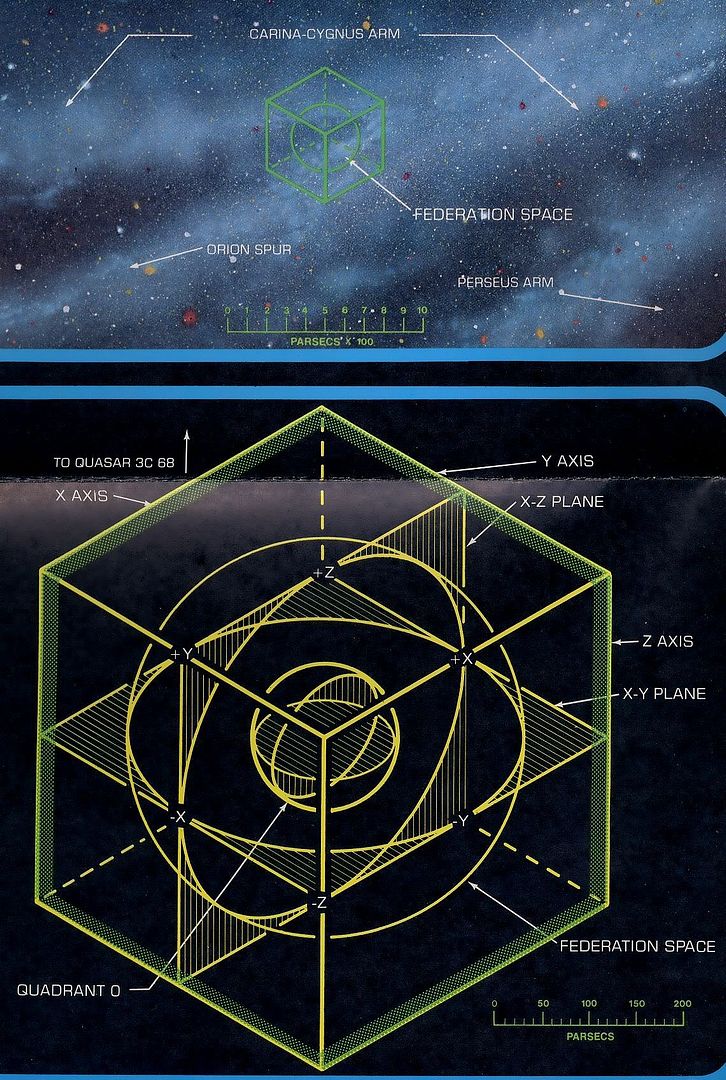
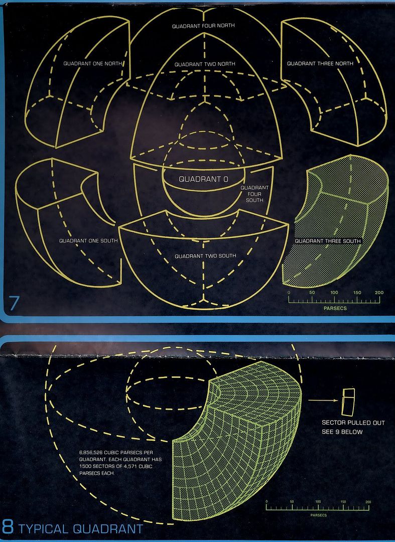
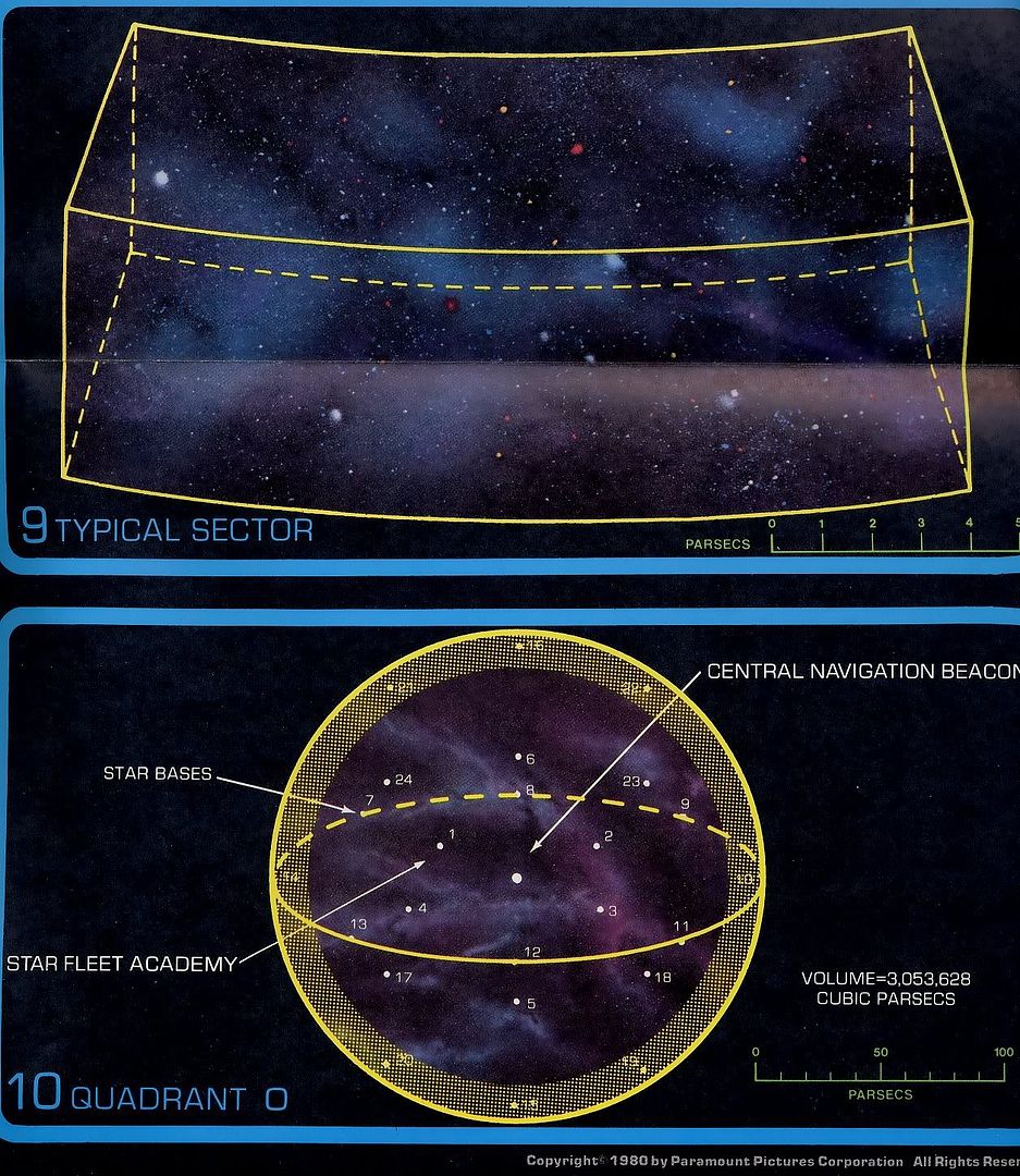
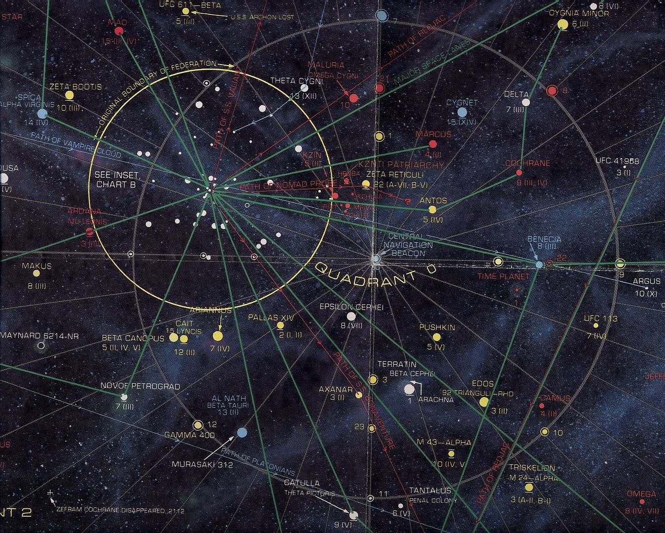
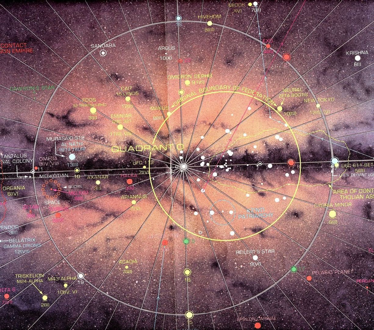
Here are the relevant sections of the maps, showing the location of the Federation in the galaxy and the organization of its quadrants and sectors (Sol is in Quadrant 0, at the center of the "Original Boundary of Federation"):
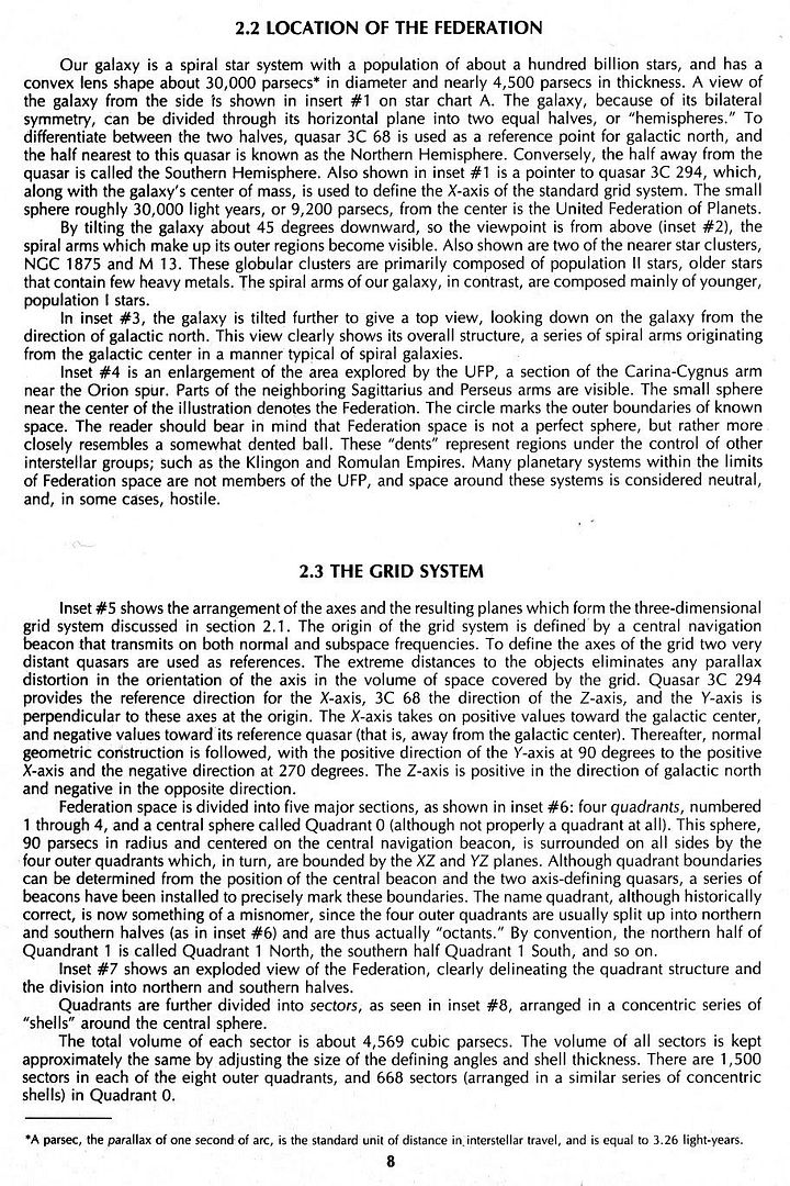
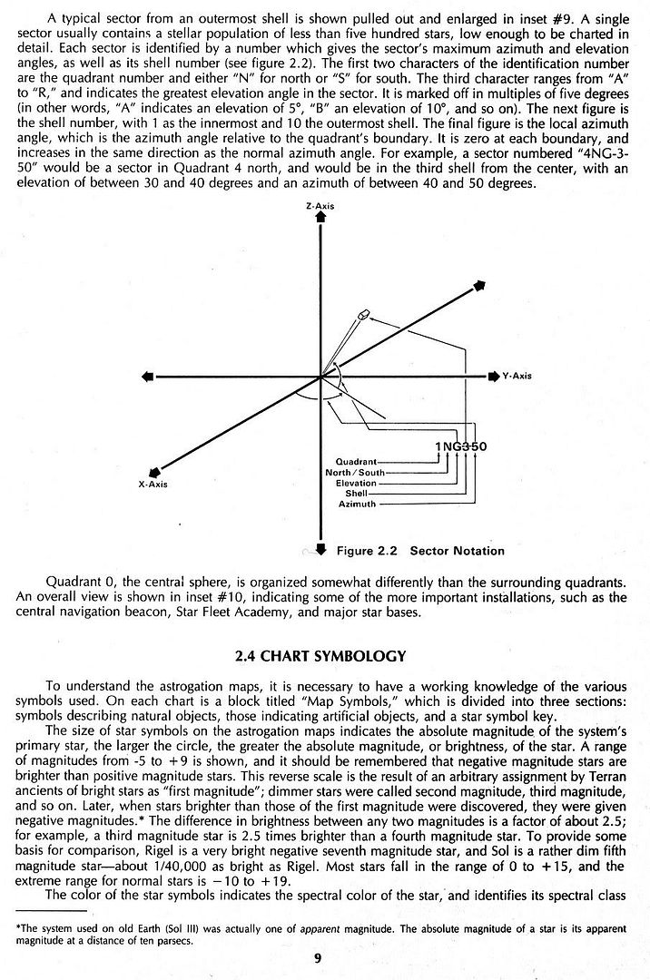
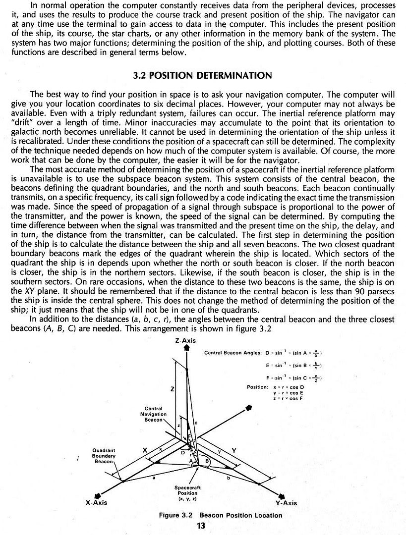
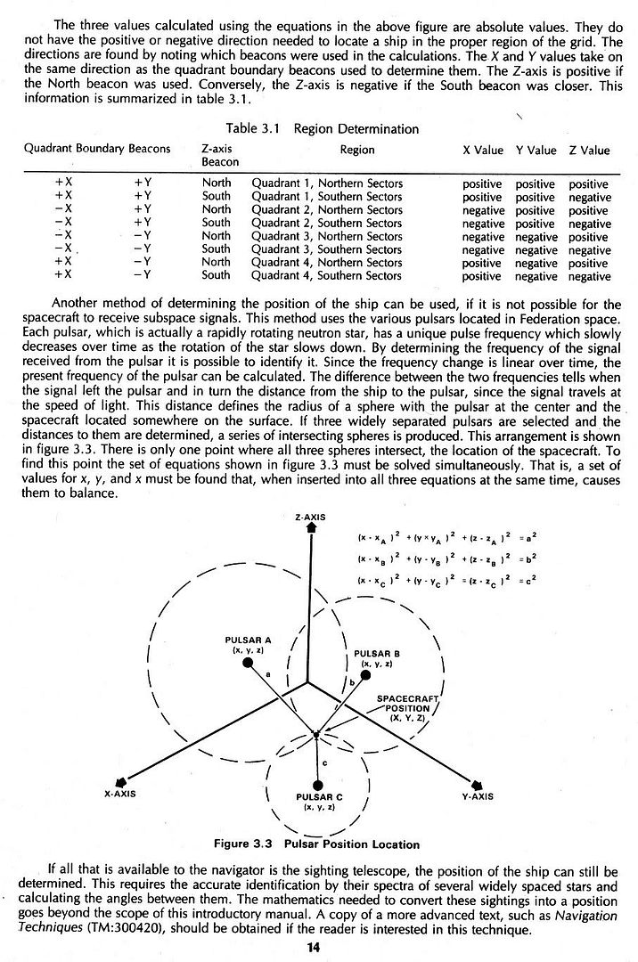
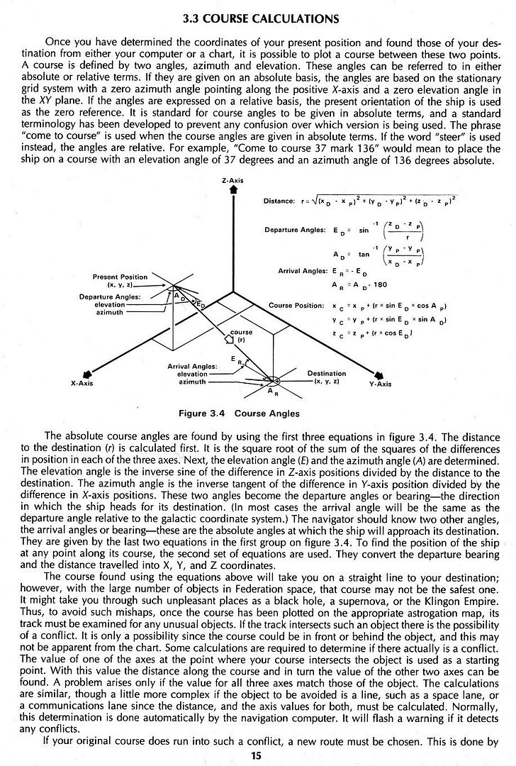
And here are the sections of the Introduction to Navigation booklet that explain the maps' coordinate/grid systems (first three pages) and position/course calculations (last three):

")
