http://www.nasa.gov/topics/earth/features/20090629.html
That picture of course doesn't even remotely show the available detail.
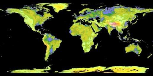
NASA and Japan's Ministry of Economy, Trade and industry (METI) released the Advanced Spaceborne Thermal Emission and Reflection Radiometer (ASTER) Global Digital Elevation Model (GDEM) to the worldwide public on June 29, 2009. The GDEM was created by processing and stereo-correlating the 1.3 million-scene ASTER archive of optical images, covering Earth's land surface between 83 degrees North and 83 degrees South latitudes. The GDEM is produced with 30-meter (98-feet) postings, and is formatted as 23,000 one-by-one- degree tiles. The GDEM is available for download from NASA's EOS data archive and Japan's Ground Data System. In this colorized version, low elevations are purple, medium elevations are greens and yellows, and high elevations are orange, red and white.
That picture of course doesn't even remotely show the available detail.